Research Symposium
23rd annual Undergraduate Research Symposium, April 6, 2023
Alycia Drapcho Poster Session 4: 4:00 pm - 5:00 pm/ Poster #176

BIO
I'm a sophomore from Orlando FL, and am an art and geography dual major here at FSU. I was drawn towards this project because I was interested in what working with GIS is like, as it's commonplace in the geography field of work .
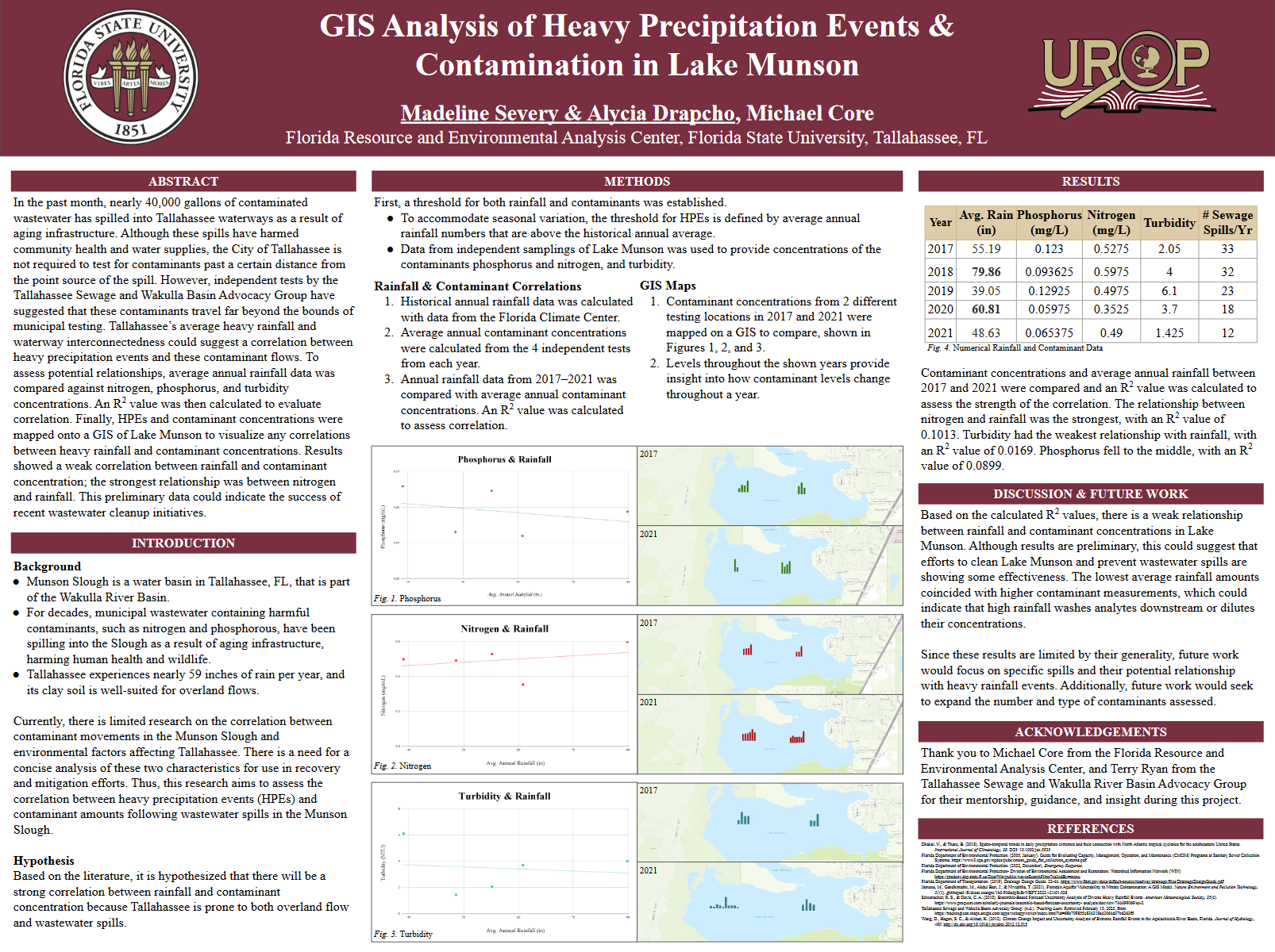
GIS Analysis of Heavy Precipitation Events & Contamination in Lake Munson
Authors: Alycia Drapcho, Michael CoreStudent Major: Studio Art, Geography
Mentor: Michael Core
Mentor's Department: Geography Mentor's College: College of Social Sciences Co-Presenters: Madeline Severy
Abstract
In the past month, nearly 40,000 gallons of contaminated wastewater has spilled into Tallahassee waterways as a result of aging infrastructure. Although these spills have harmed community health and water supplies, the City of Tallahassee is not required to test for contaminants past a certain distance from the point source of the spill. However, independent tests by the Tallahassee Sewage and Wakulla Basin Advocacy Group have suggested that these contaminants travel far beyond the bounds of municipal testing. Tallahassee’s average heavy rainfall and waterway interconnectedness could suggest a correlation between heavy precipitation events and these contaminant flows. To assess potential relationships, average annual rainfall data was compared against nitrogen, phosphorus, and turbidity concentrations. An R2 value was then calculated to evaluate correlation. Finally, HPEs and contaminant concentrations were mapped onto a GIS of Lake Munson to visualize any correlations between heavy rainfall and contaminant concentrations. Results showed a weak correlation between rainfall and contaminant concentration; the strongest relationship was between nitrogen and rainfall. This preliminary data could indicate the success of recent wastewater cleanup initiatives.
Keywords: GIS, rainfall, pollution, contamination, environment


